TSCID ROAD REPAIRS
The following images show issues that the TSCID has repaired.
Location: 5270 East Ponce de Leon Avenue
Details: Downed utility wire with equipment attached
Location: 5430 East Ponce de Leon Avenue
Details: Debris in stormwater inlet
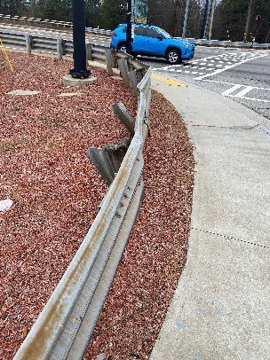
Location: 5501 East Ponce de Leon Avenue
Details: Damaged guardrail
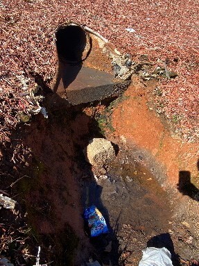
Location: 5503 East Ponce de Leon Avenue
Details: Erosion at stormwater outlet
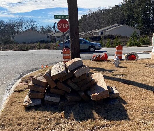
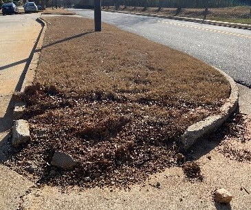
Location: 5522 East Ponce de Leon Avenue
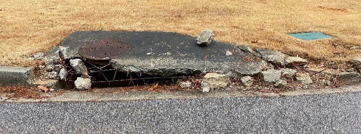
Details: Loose granite at curb near shoulder
Location: 5631 East Ponce de Leon Avenue
Details: Erosion at stormwater outlet

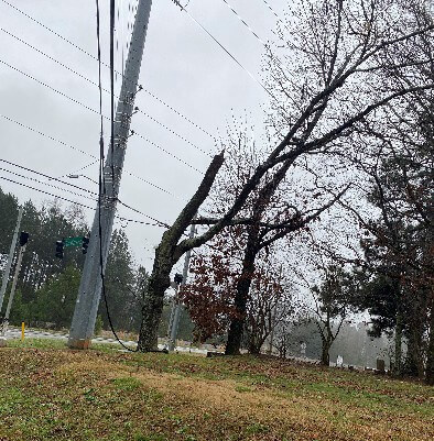
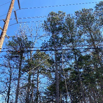
Location: 5924 East Ponce de Leon Avenue
Details: Hazardous wires hanging from utility line
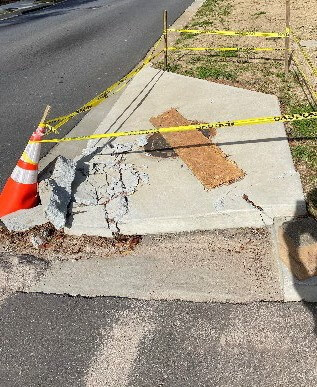
Location: 1481 Rock Mountain Boulevard
Details: Concrete deterioration and cracking at the curb. Radius needs widening to allow clearance for commercial transport carriers
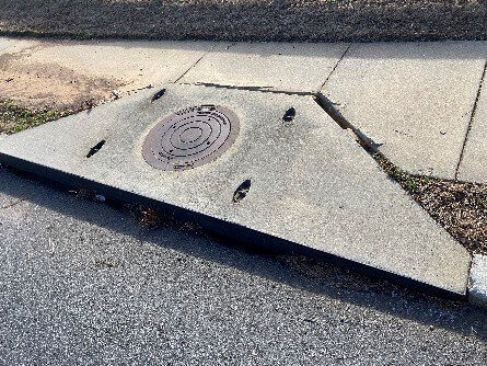
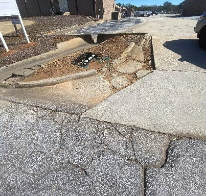
Location: Rock Mountain Boulevard
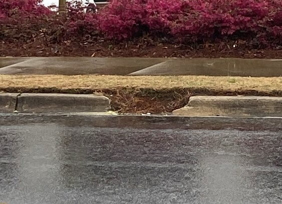
Details: Concrete deterioration and cracking with displaced catch basin not allowing stormwater drainage
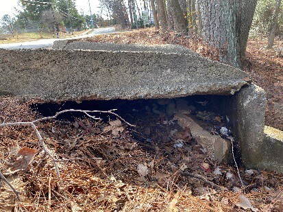
Location: 1524 Roadhaven Drive
Details: Erosion at drainage structure
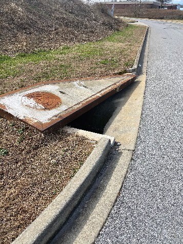
Location: 1661 Roadhaven Drive
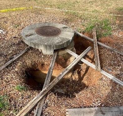
Details: Collapsed catch basin
Location: Ashbrooke Trace
Details: Concrete deterioration and exposed rebar at catch basin
Location: 4571 Greer Circle
Details: Broken concrete curb at gutter
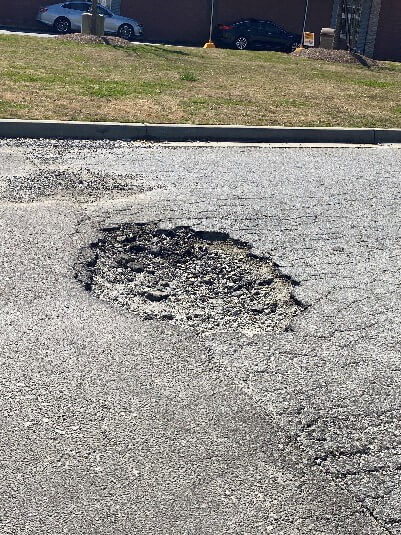
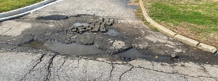
Location: 1986 Tucker Industrial Road
Details: Large pothole in pavement and cracking along concrete curb
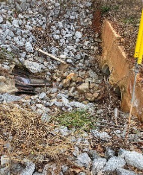
Location: 2140 Flintstone Drive
Details: Erosion and construction material near drainage inlet
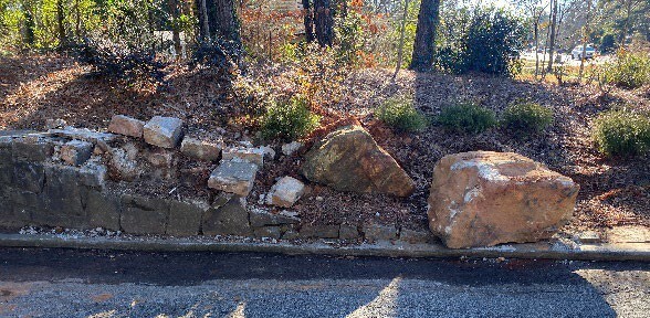
Location: North Royal Atlanta Drive
Details: Hazardous broken rock near slope
Location: 1939 Forge Street
Details: Broken concrete flume and block cracking in pavement
Location: 4720 Roger Marten Way
Details: Large pothole and displaced catch basin